

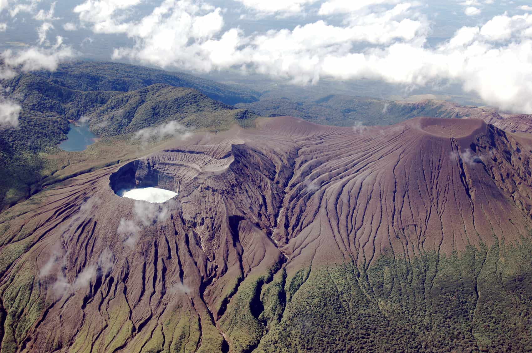
If you have a Rincón de la Vieja hike or a hot springs day trip on your calendar, the volcano’s official activity level went up last week — and the change is worth not only knowing about but understanding before you drive out there.
The Volcanological and Seismological Observatory of Costa Rica (OVISCORI) moved Rincón de la Vieja from warning to caution on 24 July, the third rung on a four-step scale. Since 2 July the observatory has counted 38 phreatic eruptions at the crater. Three of them sent lahars down the northern flank. The strongest, on 20 July, was the most energetic eruption the volcano has produced all year.
Volcanologist Geoffroy Avard said the decision rested on more than the eruption count. Seismic activity has picked up. The shape of the volcano itself is changing measurably and to get technical, the Sulphur dioxide output is up. Put together, those three signals point the same direction, and the observatory said further eruptions of equal or greater intensity are possible. In a nutshell, this is not a report that something happened but a report that something is more likely to happen again.
What caution actually means
Costa Rica’s volcano scale runs from one to four. Level one is calm. Level two, warning, is where Rincón de la Vieja has spent most of the last several years — small eruptions, gas, hot springs bubbling harder than usual, mild swelling of the summit. Ash falls lightly if it falls at all.
Level three, caution, is a step up in what the volcano is capable of on short notice, not a declaration that it is erupting now. It means bigger explosions are on the table, rocks can be thrown further from the crater, ash can travel, and lahars are an expected consequence rather than a surprise. Level four is reserved for a major eruption in progress.
Nothing about level three closes the area, cancels flights or triggers evacuations. What it does is shrink the margin for error close to the crater, which is exactly where the hardest hiking in the park goes.
Why the rivers turn grey
Those downhill from the volcano reported the Azul and Pénjamo rivers running a milky grey earlier this month after eruptive episodes. That color is the most reliable early warning system in the area, and it is worth knowing what it signals.
Rincón de la Vieja has an acidic lake sitting inside its active crater. A phreatic eruption happens when groundwater or lake water hits something hot enough to flash it to steam, and the pressure blows out through the top. There is no lava involved. What comes out is steam, gas, rock and a great deal of water and sediment.
That water and sediment goes somewhere. The crater’s northern rim is the lowest, so the flow spills that way and races downhill as a lahar — essentially a fast-moving slurry of water, ash, mud and rock with the consistency of wet concrete. It picks up more material from the riverbed as it goes. By the time it reaches the lowland farming communities on the Upala side, the river is grey, smells of sulphur and is running higher than it was an hour earlier.
Rain makes this worse rather than better, which is important to know in late July. Heavy rain at the summit mobilizes loose volcanic material that is already sitting on the slopes, so a lahar can come down without a fresh eruption to announce it.
The historical record shows what these flows can do. In November 1995 a lahar took out the bridge over the Pénjamo entirely. In 2019 the same river rose more than four metres (13 feet) in minutes and widened by six metres (20 feet) on each bank. Dead fish have turned up in the Río Niño, 15 kilometres (nine miles) from the crater, after past events.
If you are near one of these rivers and the water changes color, rises or starts to smell of sulphur, get away from the channel and onto higher ground. Do not wait to see how big it gets. That is the whole safety rule, and it works because lahars travel much faster than people can outrun them along a riverbed.
What is open in the park
Rincón de la Vieja National Park covers 14,300 hectares (35,300 acres) and is the busiest protected area in the Guanacaste Conservation Area. It sits about 23 kilometres (14 miles) from Liberia, which is why it shows up on so many itineraries. Visitation splits between two sectors, Las Pailas and Santa María.
The Active Crater trail — eight kilometres one way, 16 kilometres (10 miles) round trip, climbing roughly 1,000 metres (3,300 feet) — has been closed for years. Volcanic activity and unsafe crater gases keep it shut, and last week’s level change does nothing to reopen it. Anyone selling you a summit hike is selling you something the park is not permitting.
The Las Pailas loop is the main draw and the reason most visitors come. It runs three kilometres (1.9 miles) on a circuit past fumaroles, boiling mud pots and steam vents that sit between 78 and 106 degrees Celsius (172 to 223 degrees Fahrenheit). It is well marked and partly paved. The waterfall trails to La Cangreja, five kilometres (3.1 miles) out, and Catarata Escondida, 4.3 kilometres (2.7 miles), are longer and harder.
Confirm the day before you go. Area and trail closures at this park have historically arrived with no notice, sometimes on the morning of, and travelers have turned up at the gate to be told a trail shut days earlier. Park staff at the entrance know the current status. A tour operator’s website from last season does not.
All tickets must be bought in advance through the park service’s online reservation system. There is no cash or card payment at the gate.
What closes first if the level rises
The pattern here in Costa Rica is consistent, and it works outward from the crater. Summit and crater-adjacent trails go first — those are already shut here. Next come the longer backcountry trails that put hikers hours from an exit, which is where the waterfall routes sit. Then the visited sectors themselves close, sometimes one at a time, sometimes both.
Hot springs resorts and private reserves on the volcano’s flanks operate independently of the park and make their own calls, so a park closure does not automatically mean your hot springs booking is cancelled, or the reverse. Full closures of an entire area have happened repeatedly at active volcanoes and have lasted anywhere from a day to several weeks. Build that possibility into a tight Guanacaste itinerary rather than assuming a single fixed day at the park will hold.
Poás is active too
Rincón de la Vieja is not the only volcano the observatory is watching. Poás, far more accessible from the Central Valley and San José, is producing low-intensity eruptions of its own. Poás has its own history of abrupt closures over gas emissions and ashfall, including multi-week shutdowns. If you are choosing between the two on a short trip, check both before committing.
Where to check
The observatory monitors Rincón de la Vieja continuously through seismic stations, gas-measuring equipment, cameras and field observation, and publishes changes as they happen. Level changes in either direction are announced rather than quietly applied — the volcano was moved down from caution to warning in a previous cycle, and it could go either way again.
The behavior on display now is not new for this mountain. Rincón de la Vieja has run through active phases and quiet ones since 2011, with stretches of daily small eruptions followed by months of little. What the level change records is that the current stretch is more energetic than the last one, and that the instruments suggest it has further to run.





