
Fundación MarViva has published two resources on the Gulf of Nicoya that together make a single argument: the people who have fished, gathered and lived along the gulf for generations should hold real decision-making power over what happens to it, rather than watching those decisions come from elsewhere.
One is a governance study built with eight pilot communities around the gulf. The other is an illustrated manual documenting the region’s geological, archaeological and cultural heritage. The governance document, Gobernanza marina en el Golfo de Nicoya: metodología de evaluación aplicada a un diagnóstico participativo, runs to 73 pages and was written by Juan Pablo Zamora Rodríguez and Laura Vargas Castro.
It sets out a diagnostic tool that scores marine governance across nine dimensions — participation, legitimacy, transparency, justice, equity, coordination, knowledge, education and wellbeing. The pilot communities named in the report include Quebrada Honda, Puerto Níspero, Puerto Pochote and Puerto Thiel, along with Bocana Sur, Palito and Montero on Isla Chira. The methodology was designed to be repeated elsewhere in Costa Rica and across Latin America.
The study frames the gulf as a place under pressure from four directions at once. Illegal, unreported and unregulated fishing erodes the stock. Institutional fragmentation leaves rules unenforced. Climate change acts as what the report calls a threat multiplier, through warming water, ocean acidification and more frequent extreme weather. And communities are steadily losing their grip on the coastline itself.
What the diagnostic found was a study in contrasts. The strengths are real and, in the authors’ reading, the foundation for everything else. Community organization is strong, with recognized local structures in most places assessed — a water management association in Quebrada Honda, a Marine Area for Responsible Fishing in Puerto Níspero, an association of mollusk gatherers in Puerto Thiel.
Local ecological knowledge is also alive and still being passed down, particularly where artisanal fishing remains active. Fishers time their trips to lunar cycles, tides and spawning seasons, a body of technical knowledge transmitted orally across generations.
The weaknesses are where the report is blunt. Access to environmental justice scored lowest and most consistently across the communities studied. In Puerto Pochote, formal complaint mechanisms were described as little known, complicated or expensive, producing resignation in the face of environmental damage. In Puerto Níspero, mechanisms exist but effective access is limited by procedural barriers, long response times and no institutional support to navigate them.
Residents also reported a sense that the rules are written without regard for how they actually live, and that enforcement falls harder on the local artisanal fisher than on outside operators. Technical information about fish stocks or coastal planning, when it arrives at all, arrives late and in language communities cannot readily use.
Running underneath all of this is a concept the report calls despojos azules, or blue dispossession. It describes a gradual process in which coastal communities lose access to, control over, and eventually their cultural connection with their own marine spaces, displaced by external economic interests or by management models decided in distant offices.
In practice, the authors write, it looks like a commonly used beach becoming private property that neighbors can no longer enter, or a traditional fishing ground handed over as a concession. The report identifies forced migration and the rising cost of living driven by foreign money entering the region as mechanisms through which this dispossession occurs.
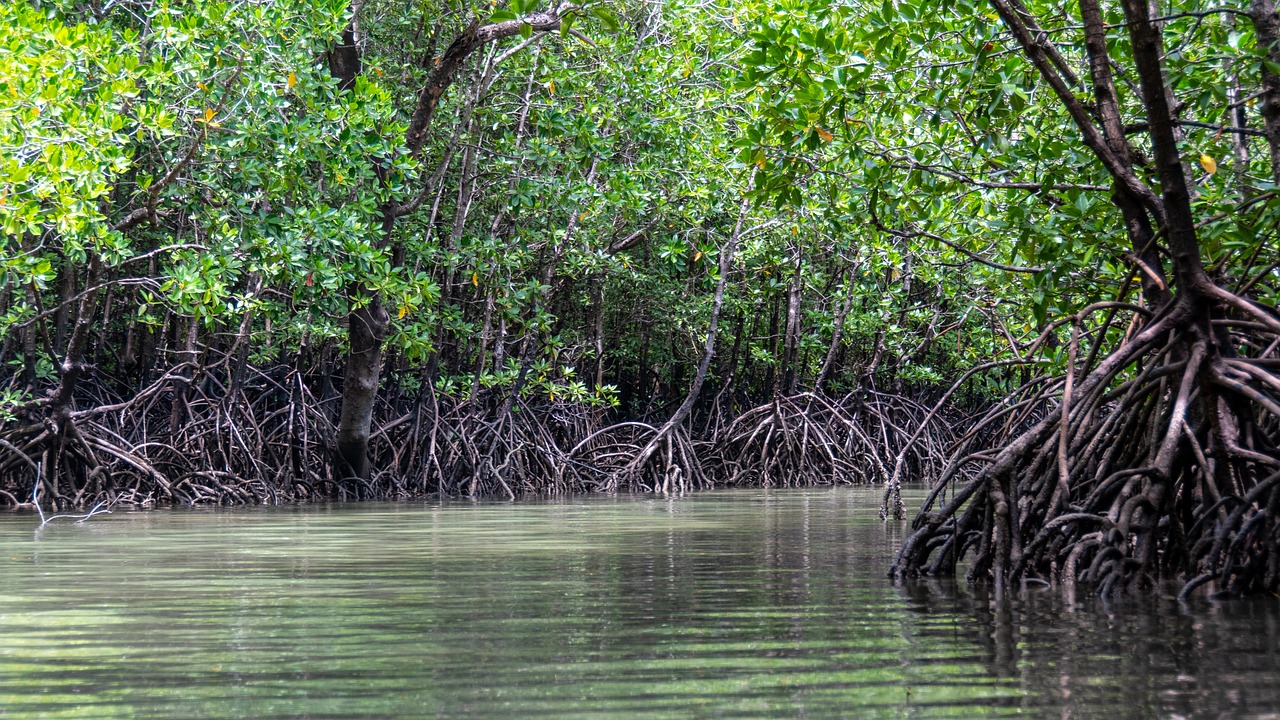
The institutional picture the study describes is dense. Managing a single mangrove can involve the national conservation system because it is a wetland, the fisheries institute because it is a fishing zone, the municipality because of coastal zoning, and the Health Ministry because of water quality — with no clear protocol tying them together.
Costa Rica does have the architecture on paper. A 2018 executive decree created a Marine Governance Commission, Marine Governance Units, local Marine Committees and Marine Master Plans. The report’s assessment is that these remain more design than practice, and it calls for them to be fully activated with operating budgets, regular meetings and public minutes.
The authors also note that Costa Rica hosted the signing of the Escazú Agreement, the regional treaty guaranteeing environmental access to information, participation and justice, but has not ratified it.
The second publication, Patrimonio biocultural del Golfo de Nicoya, is a graphic manual by archaeologist Ifigenia Quintanilla that traces the region from its geological formation through pre-Columbian settlement to the present. It documents archaeological sites in the mangroves themselves — evidence that these ecosystems have been inhabited and used for centuries — and pre-Columbian cemeteries on the Nicoya Peninsula whose jade pendants, carved stone tools and fine ceramics fed more than a century of looting.
It also records what is still living. Hand-line fishing as practiced on Isla Chira, mollusk gathering in the mangroves done mainly by women, artisanal salt production, coastal cooking built on what the sea provides, religious festivals, and the mangrove ghost stories that get told and retold. The manual’s argument is that none of this is folklore to be filed away, but an active part of how these communities organize themselves and persist.
The recommendations that close the governance study are practical rather than sweeping. Simplify complaint procedures and publicize them in plain language across print, radio and digital formats. Set up local points where people can get legal guidance and follow-up, possibly through municipalities, universities and NGOs working together.
Build formal channels for scientific and local knowledge to inform each other rather than one overriding the other. Map culturally significant sites with the communities that use them. Write access rules that account for the gap between a small-scale fisher and a well-capitalized operator.
Costa Rica’s marine territory is roughly 92 percent larger than its land area, and the inner Gulf of Nicoya is among its most biologically productive stretches. The study’s closing position is that governing it well will depend less on adding regulation than on deciding who gets a seat at the table when the rules are written.