
Costa Rica’s National Emergency Commission (CNE) says 1,361 people have been evacuated due to landslides and flooding related to Eta, which made landfall in Nicaragua on Tuesday as a Category 4 hurricane.
Eta, which has since weakened to a Tropical Depression, will indirectly cause heavy rainfall in many parts of Costa Rica through Thursday, according to the National Meteorological Institute (IMN).
While more than a dozen cantons across the entire Pacific region have established emergency shelters, Guanacaste and the Southern Zone have been the most significantly affected.
In the cantons of Coto Brus and Corredores, overflowing rivers and landslides have blocked passage on several roads and bridges. There and in Guanacaste, 19 communities remained inaccessible as of Thursday morning due to landslides or collapsed bridges.
According to the CNE’s latest updates, released Thursday morning:
- 1,361 people have been evacuated to 40 shelters across 16 cantons. This number is expected to increase Thursday as intense rain continues. Two of the shelters are reserved for people who have tested positive for COVID-19.
- 127 landslides have been reported across Costa Rica, blocking or damaging roads.
- At least 600 adverse events related to the weather have been reported across 60 cantons. These include road obstructions, and people are advised against driving to areas that have been placed under an Orange or Red Alert.
The Public Works and Transport Ministry (MOPT) and CNE have reported 41 road blockages, including the following major road closures due to the weather:
- Route 226 is closed as a result of several landslides caused by the rains from the San Cristóbal Sur cemetery to San Pablo de León Cortés. Alternate route through the Interamericana Sur (Cartago-El Empalme).
- The passage on Route 2 at Cerro de la Muerte remains closed, at kilometer 105 (Division) and at kilometer 117 (La Hortensia), as new landslides have occurred.
- Route 238, 800 meters from Bar el Rodeo, Golfito, has a total closure.
- Route 27, the highway connecting San José with Caldera, is closed at Poncho Mora.
- Route 34, entrance to Sardinal, closed.
- Route 224, Cachí bridge, closed (related to previously scheduled works).
- Ruta 244, Pejibaye de Pérez Zeledón, closed.
- Route 126, Vara Blanca, regulated passage.
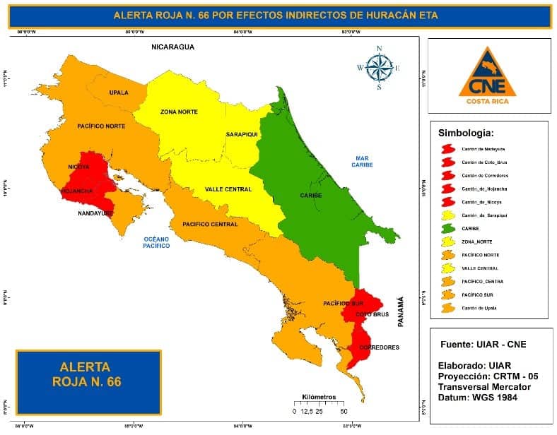
The following regions are under an Orange Alert or Red due to heavy rainfall and saturated soils, which increase the risk of landslides and flooding:
Dial 9-1-1 in the event of an emergency in Costa Rica. English-speaking operators are available.
We updated this story at 9:30 a.m. with actualizations from the CNE.


