

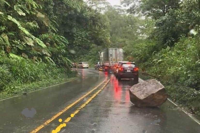
Costa Rica’s main highway between San José and the Caribbean remained closed this morning after heavy rain triggered landslides at several points along Route 32. The Ministry of Public Works and Transportation (MOPT) closed the highway at 5:40 p.m.yesterday, after falling debris made conditions unsafe for motorists.
Authorities planned to inspect the affected sections this morning and begin clearing material before deciding when traffic could resume. No estimated reopening time had been announced. The closure affects the Braulio Carrillo highway, the principal road linking the Central Valley with Limón and Costa Rica’s Caribbean coast.
For drivers, that means trips between San José and destinations including Limón, Cahuita and Puerto Viejo may require significantly longer alternative routes until the highway reopens. MOPT recommended two alternatives that can be used by all types of vehicles. Drivers can travel through Turrialba using Route 10 toward Siquirres, or use the Bajos de Chilamate–Vuelta de Kooper connection in northern Costa Rica.
A third alternative through Vara Blanca is available only for light vehicles so allow additional time before heading toward the Caribbean, particularly anyone visting us with hotel reservations, tours, airport connections or other scheduled activities. Route 32 is also one of Costa Rica’s most important freight corridors.
Trucks carrying cargo from Caribbean ports and exports headed toward the coast depend heavily on the highway, meaning prolonged closures can also affect commercial transportation between Limón and the Central Valley. Last night’s closure came only days after another landslide forced shutting the same highway.
Route 32 was closed on the night of October 5 after debris fell onto the road near kilometer 33. MOPT reopened the highway shortly after 10 a.m. the following morning once crews had cleared the area. The repeated closures highlight the vulnerability of the mountainous section of Route 32 through Braulio Carrillo National Park and the Zurquí area, where steep slopes and heavy rainfall frequently cause landslides.
MOPT recently identified three particularly vulnerable points along the highway at kilometers 28, 31 and 39. Costa Rica has started a bidding process for approximately $11 million in stabilization and drainage work at those locations. The projects are based partly on new topographical studies using LiDAR technology, which allows engineers to examine unstable slopes and terrain even in areas covered by dense vegetation.
The planned work is intended to provide more permanent protection in areas where authorities have traditionally relied on emergency clearing after landslides occur. Officials have not said whether last night’s landslides happened at any of those three locations. About 17,000 people use Route 32 each day, according to MOPT, making closures especially disruptive for anyone going between the Caribbean and the rest of the country.
Until MOPT confirms the highway has reopened, drivers should avoid Route 32 and use one of the designated alternatives. Drivers should also check road conditions before beginning a trip, as continued rainfall can affect both Route 32 and alternative roads during Costa Rica’s rainy season.





