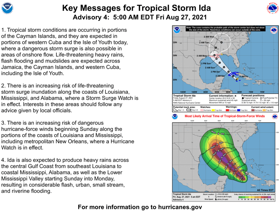
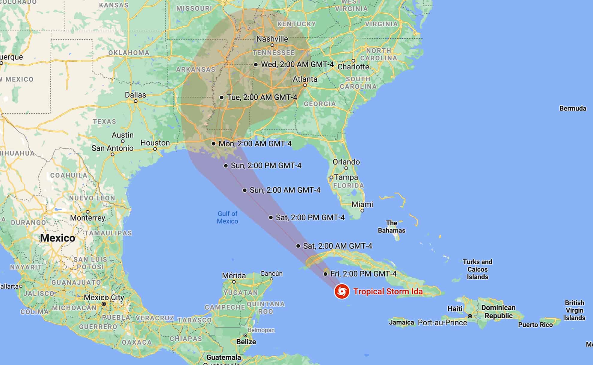
The National Hurricane Center (NHC) predicts Tropical Storm Ida will develop into a major hurricane and make landfall in the United States on Sunday or Monday.
Ida is currently 75 miles north-northwest of Grand Cayman Island in the Caribbean and has maximum sustained winds of 60 mph. The latest update from U.S. authorities, issued Friday morning, reads as follows:
Ida is moving toward the northwest near 15 mph (24 km/h) and this general motion should continue over the next few days. On the forecast track, the center of Ida will move away from the Cayman Islands this (Friday) morning, pass near or over the Isle of Youth and western Cuba later today, and move over the southeastern and central Gulf of Mexico tonight and Saturday. The system is forecast to approach the U.S. northern Gulf coast on Sunday.
Ida is forecast to strengthen into a hurricane over the southeastern Gulf of Mexico. The NHC forecasts it will be at or near major hurricane strength when it approaches the northern Gulf coast.
A “major hurricane” is a Category 3 or higher storm, indicating sustained winds of at least 111 mph. A major hurricane can cause devastating or catastrophic damage.
Southeast Louisiana, Mississippi and Alabama could be in Ida’s path, and storm watches have been issued for that area of the United States. Dangerous weather events may occur outside of Ida’s projected path. For more information, follow the NHC and local authorities.


