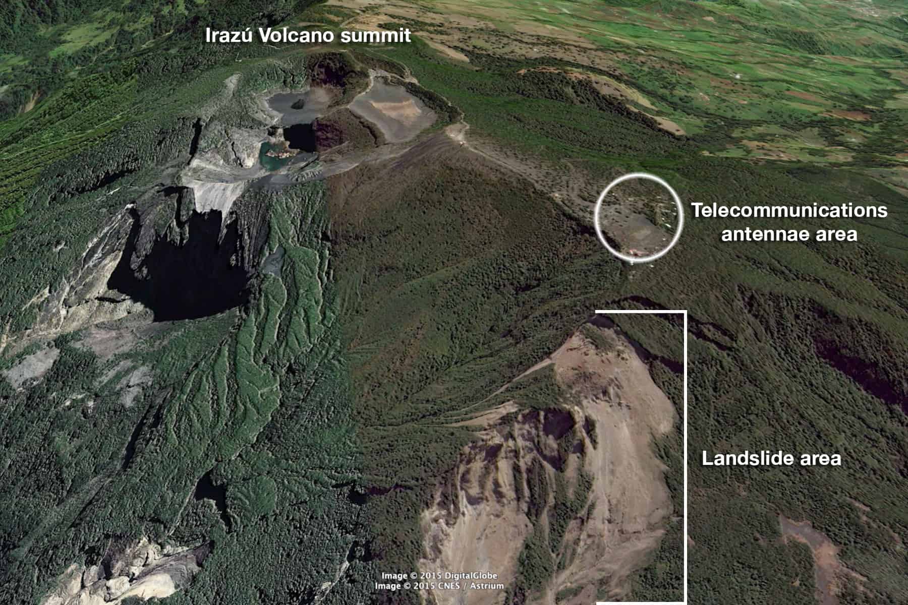
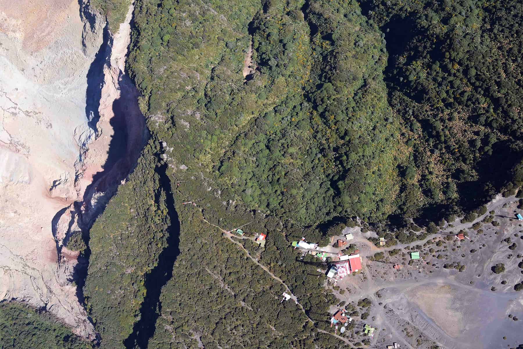
Scientific staff from the Volcanological and Seismological Observatory of Costa Rica (OVSICORI) began a ground inspection Monday in an area near the Irazú Volcano where various landslides have collapsed the ground, forming a steep canyon. In recent months, 15 hectares of land have collapsed.
The group will evaluate soil conditions, GPS information and seismic data recorded by instruments on the volcano, which is located 54 kilometers northeast of San José in the province of Cartago.
At 3,432 meters (11,259 feet) in altitude, Irazú’s high points are used by government agencies and several TV and radio stations for their antennae and telecommunication facilities.
Based on Monday’s inspection results, OVSICORI’s experts will decide whether some of the 84 telecommunications towers on Irazú need to be relocated to safer ground.
OSVISORI’s volcanology and geochemistry expert María Martínez Cruz said the observatory received reports last Friday of at least seven landslides in an area some 400 meters from the telecommunications area.
Technical staff from some of the stations reported the landslides while they were working on towers located a few hundred meters from the collapsed terrain.
“They heard debris falling into an area northwest of Irazú’s summit, however at this time we are not able to point to an exact location where these recent landslides occurred or (report) the amount of falling debris,” Martínez said Monday. “But they all said they heard debris falling at the site where the main canyon formed.”
The area is highly eroded, has lost all vegetation and soils are showing colors typically caused by high temperatures: pinks, reds, salmon and grays, she added.
OVSICORI started monitoring Irazú in January following a series of minor tremors, or microseisms, which have been occurring since December.


