

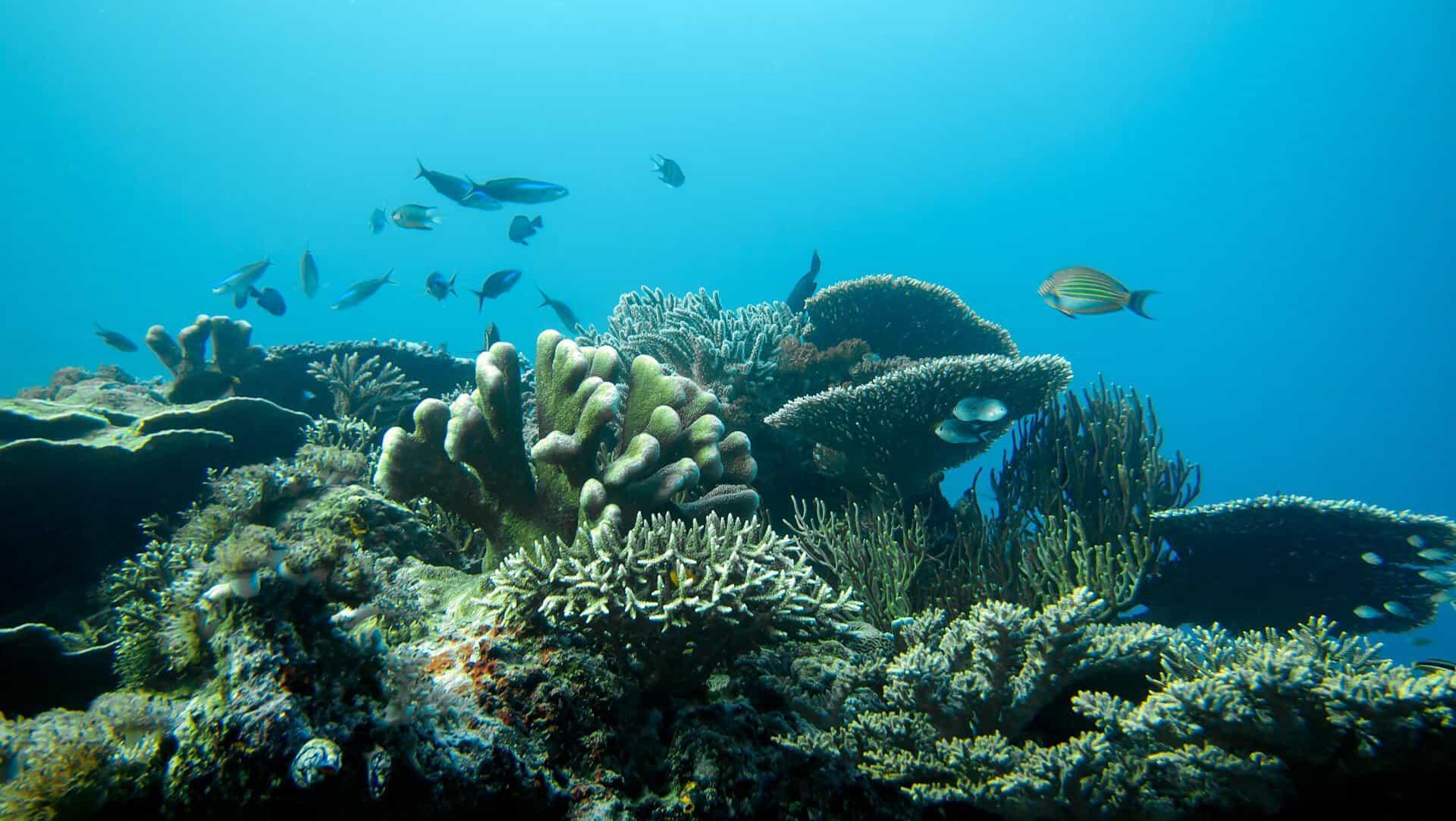
A Costa Rican conservation organization is using ordinary smartphones to create detailed three-dimensional maps of coral reefs along the country’s Pacific coast, giving researchers a new way to track the health of underwater ecosystems threatened by rising ocean temperatures and climate change.
The project, led by the nonprofit Raising Coral, is taking place in Golfo Dulce and around Caño Island Biological Reserve, two important marine habitats near the Osa Peninsula in southern Costa Rica. Instead of relying entirely on expensive underwater cameras and specialized equipment, researchers are using Samsung Galaxy smartphones to photograph sections of the reef. The images are then processed into detailed 3D models that allow scientists to examine coral growth, identify damage and measure changes over time.
The technique, known as underwater photogrammetry, involves taking numerous overlapping photographs of the same area from different angles. Computer software combines the images into a three-dimensional reconstruction, essentially creating a digital copy of the reef. These digital models give researchers a much clearer picture of what is happening beneath the surface than traditional visual inspections alone.
Marine biologist María Laura Sandoval, who manages Raising Coral’s South Pacific restoration program, explained that the technology allows conservation teams to examine entire sections of reef rather than relying exclusively on what a diver can observe during a limited period underwater.
The system also makes it possible to return to the same location months later and compare new images with earlier models, helping researchers determine whether corals are growing, declining or recovering. The project uses Samsung Galaxy S26 Ultra phones equipped with a special underwater photography feature called Ocean Mode. The technology helps improve image quality and color accuracy beneath the surface.
Once collected, the photographs are sent to researchers at the Scripps Institution of Oceanography at the University of California San Diego, where specialized software transforms them into 3D models. The effort is part of a collaboration involving Raising Coral, Samsung, the marine conservation organization SeaTrees and Scripps.
Tracking the Effects of El Niño
The project comes at an important time for Costa Rica’s Pacific reefs, which have faced repeated pressure from unusually warm ocean temperatures. During the 2023–2024 El Niño event, high sea temperatures caused widespread coral bleaching and losses around the Osa Peninsula.
Coral bleaching occurs when stressed corals expel the tiny algae living inside their tissues. These algae provide much of the coral’s food and color, so their disappearance leaves the coral looking pale or completely white. Bleached coral is not necessarily dead, but prolonged exposure to unusually warm water can prevent recovery and eventually kill it.
Researchers began using the smartphone mapping system in December 2025, initially surveying reefs approximately every four months. Since July 2026, however, the team has increased its monitoring to once a month to better observe possible changes associated with El Niño conditions.
The more frequent measurements should help scientists identify changes in coral cover and growth before they become apparent through less detailed monitoring. According to Sandoval, the technology has already helped produce information for a technical assessment supporting coral restoration around Caño Island. The surveyed areas showed coral coverage ranging from approximately 18% to 40%.
Those figures provide a snapshot of conditions in the areas studied, rather than evidence that the reefs have already recovered.
Restoring Costa Rica’s Reefs
Raising Coral has worked on reef restoration in Costa Rica since 2016, beginning in Golfo Dulce before expanding into other coastal areas. The organization grows coral fragments in underwater nurseries and later transfers them onto damaged reefs, where they can continue developing.
Some corals are attached to specially designed metal structures that hold them above the ocean floor, helping protect them from sediment while creating additional habitat for fish and other marine animals. The current restoration partnership aims to grow and transplant approximately 1,000 corals annually between 2026 and 2029, for a total of 4,000 corals across Golfo Dulce and Caño Island.
But planting corals is only part of the challenge. Conservationists must also determine whether transplanted colonies survive, continue growing and eventually help restore the surrounding ecosystem. That is where the 3D mapping technology becomes especially useful. By comparing models captured at different times, researchers can measure changes in individual coral colonies, examine the structure of the reef and monitor the return of marine life.
The information can also help conservation organizations demonstrate whether restoration efforts are producing measurable results.
Making Marine Conservation More Accessible
One of the project’s biggest advantages is its potential to make underwater research more affordable for smaller conservation organizations. Traditionally, creating detailed 3D maps of coral reefs required costly camera systems and specialized training. The use of smartphones could make the process easier for conservation teams with limited budgets.
Local residents are also participating in the project through Raising Coral’s community training program, which prepares people to work as coral gardeners and assist with restoration and monitoring. The approach creates opportunities for coastal communities to become directly involved in protecting the marine ecosystems that support fishing, tourism and other local activities.
Similar smartphone-assisted reef restoration and monitoring work is also taking place in Fiji, the Galápagos Islands and Indonesia. For Costa Rica, the technology could eventually provide a more practical way to monitor marine habitats beyond the current project sites, although its effectiveness on a larger scale still needs to be demonstrated.
Why Healthy Reefs Matter to Costa Rica
Coral reefs support a wide variety of marine life, including fish, sea turtles, sharks and countless smaller organisms. Around Caño Island, reefs provide habitat for numerous fish species and contribute to the area’s reputation as one of Costa Rica’s better-known snorkeling and diving destinations.
Golfo Dulce also supports important marine ecosystems, although its reefs face additional challenges from sediment carried into the water by rivers and runoff from surrounding land. When reefs deteriorate, the effects can extend beyond the corals themselves, reducing habitat for fish and potentially affecting the coastal communities that depend on healthy marine environments.
Restoration efforts cannot eliminate the broader threats posed by warming oceans, pollution and changing ocean conditions. However, better monitoring can help researchers understand which corals are surviving and where conservation work may be most effective. The new technology also makes the underwater world easier to understand for people who may never have the opportunity to see these reefs in person.
Instead of relying solely on scientific measurements, conservationists can use detailed 3D images to show communities, visitors and potential supporters how a reef is changing. Since Costa Rica has built much of its international reputation around protecting nature, the project offers another tool for understanding what is happening beneath the Pacific Ocean and determining whether efforts to restore its coral reefs are succeeding.