
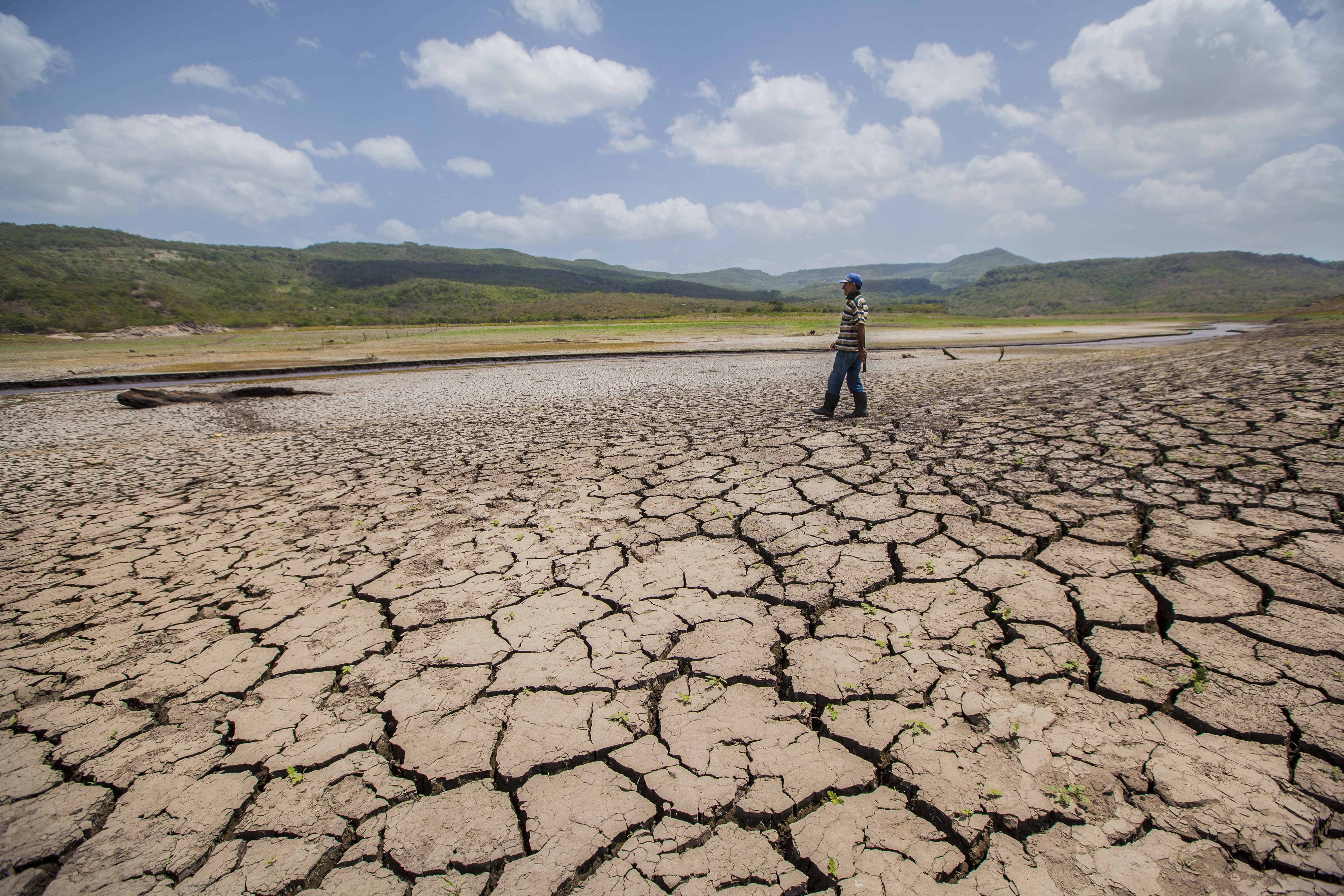
El Niño has not peaked yet. The World Meteorological Organization (WMO) expects the event to keep strengthening until around December, with sea surface temperatures in the central and eastern tropical Pacific forecast to reach the highest levels ever recorded between October and December.
In its latest Global Seasonal Climate Update, published Oct. 8, the WMO forecast that the temperature anomaly in the Niño 3.4 region, the stretch of the equatorial Pacific used to measure El Niño, will average about 3.7 degrees Celsius (6.7 degrees Fahrenheit) above normal for the October-to-December season. That would be the highest seasonal value since observations began, well above the previous record of 2.6 C (4.7 F) set between November 2015 and January 2016.
“El Niño is firmly established and strengthening rapidly,” said WMO Secretary-General Celeste Saulo. She said the agency’s forecasts show a near-100% chance the event will persist through February 2027, potentially making it one of the strongest since at least 1950. The WMO said that outlook reflects agreement among 13 national and international forecasting centers rather than a single model.
Saulo also explained why this event is running so hot. El Niño does not create new heat, she said, but releases heat the ocean has stored beneath the surface, and the waters it is drawing from are the warmest ever measured. That leaves more heat available to release, which is why a strong El Niño so often pushes global temperatures to new highs.
Costa Rica’s own records point the same way. The National Meteorological Institute (IMN) reported that on Oct. 5 the daily anomaly in the Niño 3.4 region reached about 3.4 C (6.1 F), the highest value in its records. The previous high was 3.09 C (5.6 F) on Nov. 18, 2015.
The IMN said the 2026 event is the most intense it has registered since at least its founding in 1888, and that since September it has run well ahead of both the 1997-98 and 2015-16 events. The two record figures measure different things. The IMN’s 3.4 C is a single day’s observed reading, while the WMO’s 3.7 C is a forecast average for the full three-month season.
A peak at the end of the year fits the usual El Niño cycle. Ricardo Orozco, a climatologist and researcher at the National University (UNA), said the strongest phase typically falls between November and January.
That timing overlaps with the close of the rainy season. The IMN’s latest subseasonal forecast calls for mostly below-normal rainfall across much of the country from Oct. 19 to Nov. 15, with very dry conditions in the North Pacific, Central Pacific and Central Valley from Oct. 26 onward. The Caribbean is expected to stay closer to normal for the first of those weeks.
Orozco said the dry season is likely to arrive early, with much of the country in full dry season by mid-November, adding to forecasts that El Niño could end Costa Rica’s rainy season early this year. The IMN said its official dry-season outlook will not be ready until November.
The rain that fell in late September and early October has not made up the shortfall. The North, Central and South Pacific, the Central Valley, and the northern cantons of Guatuso, Los Chiles and Upala remain under meteorological drought, according to the IMN. Orozco said the recent showers do not mean El Niño has eased or that the earlier deficit has been offset.
Water supplies were already strained before the latest forecast. In September, community water boards reported rationing in 74 communities across Guanacaste, Puntarenas and Alajuela, and the government has proposed spreading El Niño power costs over three years of electricity bills.
The forecast also lengthens the period of risk for Costa Rica’s coral reefs. This week, scientists from the State Distance University (UNED) moved 2,700 corals deeper at Isla Tortuga in the Gulf of Nicoya, from about 5 meters (16 feet) to 13 meters (43 feet), where the water stays cooler. The aim is to keep the corals alive until temperatures return to normal, since bleached corals can recover once the heat eases.
The WMO outlook suggests that relief is still months away. With the event not expected to peak until December and almost certain to last through February 2027, the warmest phase for the Pacific is still ahead rather than behind.
Globally, the WMO said the strengthening El Niño is likely to bring above-average temperatures to much of the world and shift rainfall patterns, raising the risk of drought in some regions and flooding in others. Its earlier outlook for August through October listed southern Central America among the areas most likely to see drier-than-normal conditions.