

Updated Monday at 11:40 a.m. Route 32 has reopened. The Río Chirripó bridge on Route 4 is closed.
The ground across the Caribbean can no longer absorb water. Soil saturation in Caribbean river basins sits between 90 and 100%, according to the Instituto Meteorológico Nacional, and basins in the South Pacific are above 85%. Everything that falls today runs off, which is why Costa Rica woke up under an orange alert.
If you are in the Caribbean, the Northern Zone or Turrialba, treat today as a day to change plans rather than push through them. Those areas carry the orange alert. The Central Valley, Central Pacific and South Pacific are on yellow. The North Pacific has no alert at all, so Guanacaste is not part of this.
Orange is one step below the highest level, and it is not a prediction. It means damage is already happening, which is why shelters and evacuations came before the alert rather than after it. The rain has been heavy overnight. In the six hours to 4 a.m., Puerto Viejo de Sarapiquí took 59.6 millimeters (2.3 inches) and Canta Bratsi in the South Caribbean took 57.3 millimeters (2.3 inches). The strongest gust recorded was 52 kilometers per hour (32 miles per hour) at Asada Guayabo.
More is coming, and the system driving it has not arrived yet. Tropical wave No. 33 was still sitting near the Panama border when the meteorological institute issued its 4:07 a.m. bulletin. It crosses the country during the day, on top of ground that is already at capacity.
Expect 20 to 50 millimetres (0.8 to 2 inches) over 12 hours in the Caribbean and Northern Zone, with peaks that could pass 90 millimetres (3.5 inches). The North Pacific and Central Valley are looking at 10 to 50 millimetres (0.4 to 2 inches). The Central and South Pacific get downpours with thunderstorms, generally 10 to 20 millimetres (0.4 to 0.8 inches) but with peaks to 50 millimetres (2 inches).
Trade winds stay moderate with occasional strong gusts in mountain areas, running 60 to 80 kilometres per hour (37 to 50 miles per hour). In isolated cases near storm clouds, gusts can reach 100 kilometres per hour (62 miles per hour). That is enough to bring down branches and power lines, so if you feel a sudden strong gust near a storm cloud, get indoors rather than waiting to see what happens.
Two travel warnings in this bulletin matter if you have anything booked. Pilots are advised to expect increased turbulence, so a bumpy approach into San José or Liberia today is normal rather than alarming. And sea conditions are rougher, particularly in the southern part of the North Pacific, the Gulf of Nicoya and the Central and South Pacific. If you have a boat tour, a Nicoya crossing or a Tortuguero transfer, call the operator this morning instead of assuming it sails.
There is a warning for towns too. Urban drainage systems may not cope with the volume, which means streets flood in places that are nowhere near a river. If you live or are staying somewhere that has puddled badly before, that is your indicator. The weekend already displaced people. At least 495 were in shelters as of Sunday evening, with 154 across three sites in the Caribbean, 331 across seven sites in Sarapiquí and 10 in Turrialba. The community of Ulima de Florencia was left almost entirely underwater.
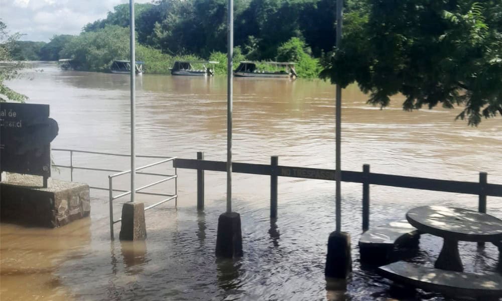
Several communities in Talamanca are cut off as the Sixaola river runs high, and homes have taken damage in Valle de La Estrella, Siquirres, Guácimo and Matina. In Sarapiquí the Tigre river has left its channel, and the Sarapiquí, Puerto Viejo and Sucio rivers are being watched.
Roads are the part most likely to change while you are reading this. Route 32 to Limón reopened early this morning, after crews checked the saturated slopes at Cerro Zurquí and cleared the material that had come down. Take that as today’s status rather than the week’s. The same road closed twice over the weekend, and while the ground stays this wet it can shut again with very little notice. Route 230 between Cot and Turrialba has slide damage, and the section of Route 415 between Turrialba and La Herediana known locally as the sinkhole remains closed. The bridge over the Río Chirripó on Route 4, between Guápiles and Sarapiquí, closed Sunday afternoon as the river came up, and no reopening has been announced.
If Route 32 shuts again, Route 10 through Turrialba and the Bajos de Chilamate–Vuelta de Kooper road will take any vehicle. Vara Blanca is the third way through, but light vehicles only. Check the status before you drive rather than relying on this or any other article, and remember that a road reopening in the morning tells you nothing about the afternoon.
Classes are cancelled at 934 schools, with all campuses closed across the Turrialba, Sarapiquí, Limón and Sulá regional directorates. The single most useful habit today is refusing to drive through standing water. You cannot see whether the road underneath is still there, and moving water needs surprisingly little depth to lift a vehicle off its wheels.
The second is giving hillsides room on mountain routes, especially where you can see fresh mud or fallen material at the pavement edge, because that means the slope is still moving. The meteorological institute updates its bulletins through the day. With wave 33 moving across the country, the afternoon is when conditions are most likely to turn.





