

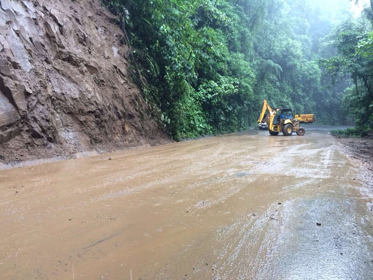
Heavy rains from Tropical Wave No. 32 left flooding, overflowing rivers, landslides and road problems across several parts of Costa Rica, while forecasters warned that unstable conditions would continue Sunday. The Caribbean and Northern Zone are expected to receive the heaviest rainfall, with moderate to strong showers possible through the morning. Rain and thunderstorms are also forecast for parts of the Pacific and Central Valley later in the day.
The weekend weather has already caused problems in Cartago, Limón and Alajuela. Turrialba was among the hardest-hit areas Saturday after heavy rainfall caused the Turrialba River to rise sharply. One house fell into the river, while other homes were affected and residents in the immediate area were warned not to return because of unstable conditions.
A landslide was also reported in San Rafael de Santa Cruz de Turrialba, affecting elderly residents. Authorities closed the Las Monjas bridge in central Turrialba as a precaution after the river current apparently damaged part of its foundation. Elsewhere in Cartago province, a landslide blocked National Route 10 in the Quebrada Honda area near Juan Viñas, while flooding affected roads in Santa Teresita de Turrialba and Río Bajo de Abarca in Alvarado.
Those heading through mountainous parts of Cartago should check road conditions before leaving, particularly on routes toward Turrialba and Irazú Volcano.Along Route 219 toward Irazú Volcano National Park, rain caused additional road damage and difficult driving conditions.
The weather also caused trouble on Route 32, the main highway between San José and Limón. A landslide closed the highway for approximately four hours Saturday before crews removed debris and reopened the road. In Matina, Limón province, flooding was reported in the Davao area. An emergency shelter was prepared in the nearby community of Larga Distancia as a precaution, although no residents had been moved there at the time of the latest report.
Farther north, overflowing rivers affected San Juan and Pataste in Guatuso, Alajuela. Police officers were sent through affected communities to determine whether families needed assistance. The risk has not ended with the passage of the tropical wave. Costa Rica remains under the influence of the Intertropical Convergence Zone, while strong trade winds continue to bring moisture from the Caribbean. Those conditions are expected to keep the atmosphere unstable Sunday.
The Caribbean and Northern Zone face the greatest risk this morning, with recurring moderate to heavy rainfall possible. The Pacific Central and South are expected to see scattered afternoon downpours and thunderstorms, while the Central Valley could experience periods of rain and isolated showers.
Strong winds are yet another concern. Gusts could reach 40 to 60 km/h (25 to 37 mph) in lower areas and 70 to 90 km/h (43 to 56 mph) in mountainous locations. The combination of additional rainfall and already saturated ground increases the possibility of new landslides, flash flooding and rising rivers. Soil saturation in mountainous Caribbean watersheds is estimated at between 70% and 100%, while areas around the Golfo Dulce in southern Costa Rica are above 90%.
The Northern Zone and Caribbean remain under a yellow weather alert, while the Central Valley and the Central and South Pacific are under a lower-level green alert. Residents and visitors traveling Sunday are advised to use additional caution around rivers, steep slopes and roads with a history of landslides. Conditions can change quickly during heavy rain, particularly on mountain highways.
Anyone driving today should also confirm road conditions before heading toward Limón, Turrialba or other areas affected by yesterday’s storms.





