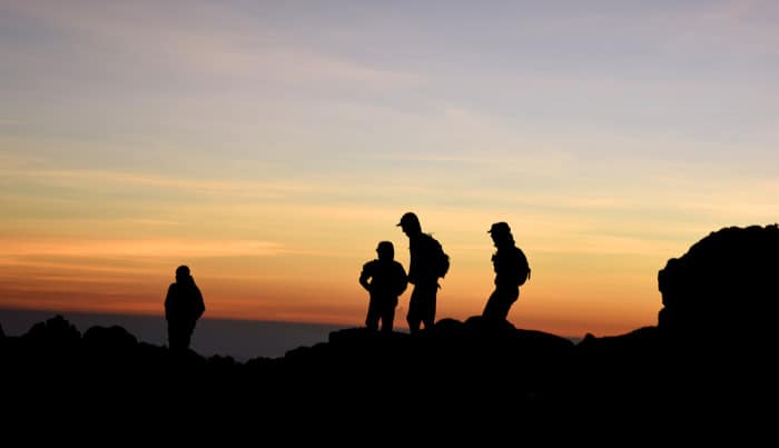
There is a moment in every mountain ascent when the question must be asked: “Why am I doing this?”
Sure, glory and bragging rights await at the summit. But while facing things like frostbite or hypothermia, with kilometers left to go, I have to think that even the world’s best mountaineers wonder why they chose physical anguish over a day of poolside margaritas.
I didn’t experience frostbite or overcome acute mountain sickness while scaling Cerro Chirripó, Costa Rica’s tallest mountain. But I’d be lying if I said every moment was characterized by ebullience and an improved sense of self-worth.
Take kilometer eight, for example, about a third of the way up our 21-km journey, where terrain difficulty level spiked. Kilometer seven was tough, but on the inclined, rocky staircase that is km eight, I came to the humble realization that my girlfriend was the better climber. Much better.
On several occasions, she ascended tens of meters ahead of me and then waited, looking down at her sweaty hulk of a boyfriend as his lungs heaved and he made excuses about the weight of his bag, a whopping 4 kilograms heavier than hers.
Though she was patient at first, it was soon evident that I could not keep up. Like the final scene from “For Whom the Bell Tolls,” when the wounded protagonist urges his lover to push on and leave him behind as the enemy draws near, I told my girlfriend to carry on without me.
“Forget me not!” I shouted. “I will forever live in your heart!” Well, maybe not that dramatic, but you get the point.
Fortunately for me, kilometers 9 through 13 are flatter and smoother. The vegetation and climate shift, too, with skeletons of leafless trees lining the path as the mountain air chills. Kilometer 13, the final ascent before reaching base camp at kilometer 14, is known as the “hill of regrets” (cuesta de arrepentidos). The name is apt, but you make it.
Almost all hikers that brave Chirripó do. It’s undeniably challenging, much more so than I expected, but hundreds of people of all ages, sizes and shapes reach the 3,820-meter (12,532-feet) peak every year. One septuagenarian couple in my group was climbing Chirripó for the 55th time. If they could do it at more than double my age, and I could not, my already waning confidence (due to my girlfriend’s mountain dominance) would have been decimated.
The magic mountain
Indigenous groups who lived in the shadow of Chirripó allegedly referred to the peak as “the magic mountain.” On a clear day at the summit, it is said that you can see both the Caribbean and Pacific coastlines. Momentarily, you are hovering above Costa Rica, looking down at the layers of rolling mountains as they descend towards the sea.
The mountain’s magic, as I interpreted it, is its geographical distinction from the rest of tropical Costa Rica. Jagged mountain formations, thin cold air, oak forests and fern groves are not traditionally associated with this country, where surfboard shorts significantly outnumber winter parkas.
Formed by glaciers that melted tens of thousands of years ago, the park’s ashen rock cliffs spiral and jut from the earth above small lakes and marshes in the valleys below. Clouds frequently roll through and cover the peaks. At night, stars glow just beyond the mountains. And if you watch the sky for a few minutes in the early morning, you’re likely to see stars cascade across the atmosphere.
Once you hit base camp, the bulk of the climb is behind you. Cerro Chirripó’s summit is an additional two-km ascent, preceded by a four- to five-km hike across the Valle de los Conejos (Rabbit Valley).
The final trek up to the peak is difficult, requiring some all-fours hand-and-foot climbing up the side of the ridge, but once you’ve gone that far, turning back is no longer a viable option. Plus, there’s a log book at the summit to write your name, securing your place in the illustrious society of Central American mountaineering legends. If that isn’t motivation to finish, I don’t know what is.
Most hikers summit Chirripó in two days. A first-day, 14-km hike to the albergue, or base camp, is the first step. After a night at the base camp, with Spartan barracks, cold water and a kitchen for guests to prepare meals, most set out early the following day to scale the peak in the morning hours before heading back down to the small towns outside Pérez Zeledón, the region’s largest city.
Descent and vengeance
Our group, organized by the Tropical Studies Organization at the University of Costa Rica, stayed two nights at camp before heading back to civilization. The downward trek is less grueling, though twisting an ankle on a slippery rock is a common fate of the weary hiker.
On the way down, motivated by the thought of a celebratory beer or two, I accelerated my pace during the final few kilometers. At the base of the trail, I waited for my girlfriend to catch up. As she neared, a fellow hiker asked her where I’d run off to.
“I beat him on the way up,” she said. “I think he wanted to beat me on the way down so I let him go ahead. He needs that sort of thing for his ego.”
Regardless of her alleged forfeit, the ego was in good shape. Forty-five kilometers in three days put my feet atop Costa Rica’s most daunting peak, all the while carrying double the weight of my girlfriend’s diminutive frame. Poolside margarita time.
Going there
Chirripó National Park is in southern Costa Rica along the Talamanca mountain range. Tracopa line buses run from San José to San Isidro de El General, also known as Pérez Zeledón. From there, it’s an additional 30-minute ride east to the entrance in San Gerardo de Rivas. Shuttles and tour operators also run direct trips and hiking excursions.


